{ "@context": "https://schema.org", "@type": "SoftwareApplication", "name": "eSTZwritR", "alternateName": "easy rider", "applicationCategory": "Scientific Software", "operatingSystem": "Windows, macOS, Linux", "softwareVersion": "0.1.1", "description": "R package for applying standardized file naming, directory structure, and mapping conventions to empirical Seed Transfer Zones (eSTZs) in the United States to streamline data sharing among natural resource professionals.", "url": "https://sagesteppe.github.io/eSTZwritR/", "downloadUrl": "https://github.com/sagesteppe/eSTZwritR", "codeRepository": "https://github.com/sagesteppe/eSTZwritR", "author": [ { "@type": "Person", "name": "Brianna Wieferich" }, { "@type": "Person", "name": "Reed Benkendorf", "url": "https://github.com/sagesteppe" } ], "programmingLanguage": "R", "keywords": [ "seed transfer zones", "eSTZ", "empirical seed zones", "native plant restoration", "germplasm", "seed collection", "ecological genetics", "restoration ecology", "spatial data", "R package", "data standards" ], "inLanguage": "en-US", "citation": { "@type": "ScholarlyArticle", "name": "Empirical seed transfer zones require conventions for data sharing to increase their utilization by practitioners", "author": [ {"@type": "Person", "name": "Brianna Wieferich"}, {"@type": "Person", "name": "Reed Benkendorf"} ], "datePublished": "??", "publisher": "??", "url": "https://github.com/sagesteppe/EmpiricalSeedZones/blob/main/manuscript/Empirical-seed-transfer-zones-require-conventions-for-data-sharing-to-increase-their-utilization-by-practitioners.pdf" }, "offers": { "@type": "Offer", "price": "0", "priceCurrency": "USD" }, "sameAs": [ "https://doi.org/10.5281/zenodo.14641975" ] }

Skip to contents

This data set contains the, slightly simplified, 12 department of interior regions. These data are simplified to save disk space, and for use with cartographic not for purposes of analysis, except for region coding. They are imported directly and silently by the regionCoding function to determine which geographic areas to append to a file name. These data are sourced from the US Department of Interior (DOI) https://www.doi.gov/employees/reorg/unified-regional-boundaries. However, the 'REB_ABB' variable, which is ultimately used by eSTZwritR, is derived here and is not an officially sanctioned abbreviation by the USDOI.

Format

A data frame/tibble/sf with 3 rows and 2 columns:

REG_NUM

Region number

REG_NAME

Region name

REG_ABB

Unofficial 2-3-letter region abbreviation

geometry

sf geometry column

Examples

regions <- sf::st_read(
file.path(
   system.file(package="eSTZwritR"),  "extdata", 'regions.gpkg'
 )
)
#> Reading layer `regions' from data source 
#>   `/home/runner/work/_temp/Library/eSTZwritR/extdata/regions.gpkg' 
#>   using driver `GPKG'
#> Simple feature collection with 12 features and 3 fields
#> Geometry type: MULTIPOLYGON
#> Dimension:     XY
#> Bounding box:  xmin: -179.2257 ymin: -14.59707 xmax: 179.8597 ymax: 71.44106
#> Geodetic CRS:  WGS 84
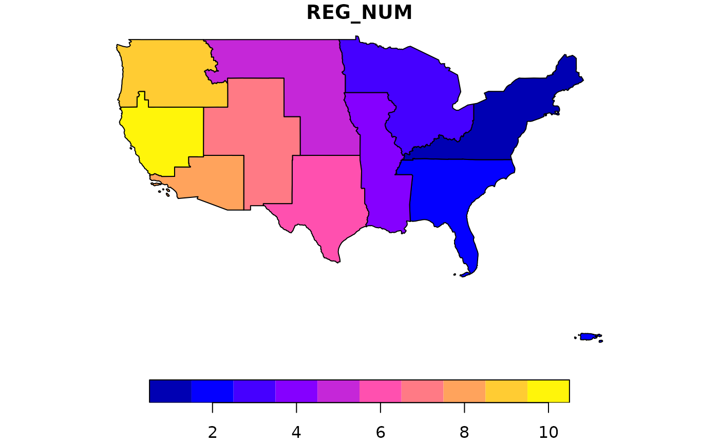
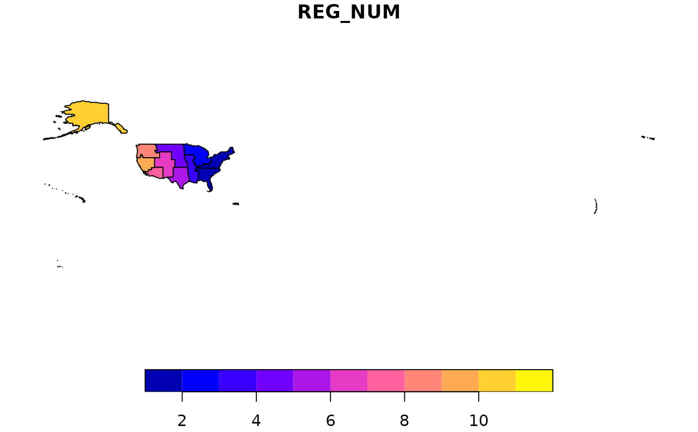
plot(regions[,1]) # those aren't errors - they are some far flung pacific islands.

plot(regions[1:10,1]) # more continental of a focus.