{ "@context": "https://schema.org", "@type": "SoftwareApplication", "name": "eSTZwritR", "alternateName": "easy rider", "applicationCategory": "Scientific Software", "operatingSystem": "Windows, macOS, Linux", "softwareVersion": "0.1.1", "description": "R package for applying standardized file naming, directory structure, and mapping conventions to empirical Seed Transfer Zones (eSTZs) in the United States to streamline data sharing among natural resource professionals.", "url": "https://sagesteppe.github.io/eSTZwritR/", "downloadUrl": "https://github.com/sagesteppe/eSTZwritR", "codeRepository": "https://github.com/sagesteppe/eSTZwritR", "author": [ { "@type": "Person", "name": "Brianna Wieferich" }, { "@type": "Person", "name": "Reed Benkendorf", "url": "https://github.com/sagesteppe" } ], "programmingLanguage": "R", "keywords": [ "seed transfer zones", "eSTZ", "empirical seed zones", "native plant restoration", "germplasm", "seed collection", "ecological genetics", "restoration ecology", "spatial data", "R package", "data standards" ], "inLanguage": "en-US", "citation": { "@type": "ScholarlyArticle", "name": "Empirical seed transfer zones require conventions for data sharing to increase their utilization by practitioners", "author": [ {"@type": "Person", "name": "Brianna Wieferich"}, {"@type": "Person", "name": "Reed Benkendorf"} ], "datePublished": "??", "publisher": "??", "url": "https://github.com/sagesteppe/EmpiricalSeedZones/blob/main/manuscript/Empirical-seed-transfer-zones-require-conventions-for-data-sharing-to-increase-their-utilization-by-practitioners.pdf" }, "offers": { "@type": "Offer", "price": "0", "priceCurrency": "USD" }, "sameAs": [ "https://doi.org/10.5281/zenodo.14641975" ] }

Skip to contents

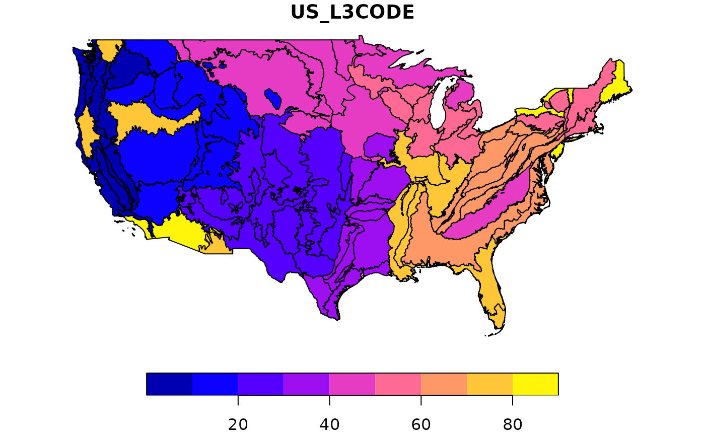
This data set contains the, highly simplified, level 3 ecoregions for the USA. These data are simplified to save space, and for use with cartographic, not for analytical purposes. They are imported directly and silently by the mapmaker function to contextualize eSTZ border. These data were sourced from the United States Geological Survey (usgs) https://www.sciencebase.gov/catalog/item/55c77f7be4b08400b1fd82d4

Usage

omernik

Format

A data frame/tibble/sf with 3 rows and 2 columns:

US_L3CODE

Ecoregion code

US_L3NAME

Full ecoregion name

geometry

sf geometry column

Examples

plot(omernik[,1])